


A getaway on the Côte Bleue
Niolon, from the small harbour to the batteries of the Côte Bleue
Text and photographs by Vincent Flachaire
On the Côte Bleue, Niolon’s houses cluster around a small harbour facing Marseille. Above the harbour, the Côte Bleue train crosses the hills through tunnels and over viaducts, while former gun batteries overlook the bay.
A small harbour facing the Bay of Marseille
Niolon belongs to the municipality of Le Rove, at the foot of the Estaque hills. The valley opens into a narrow limestone cove facing the Bay of Marseille. The road descends to the harbour and ends there. Above the houses, the railway follows the coast towards Martigues, then continues to Miramas.
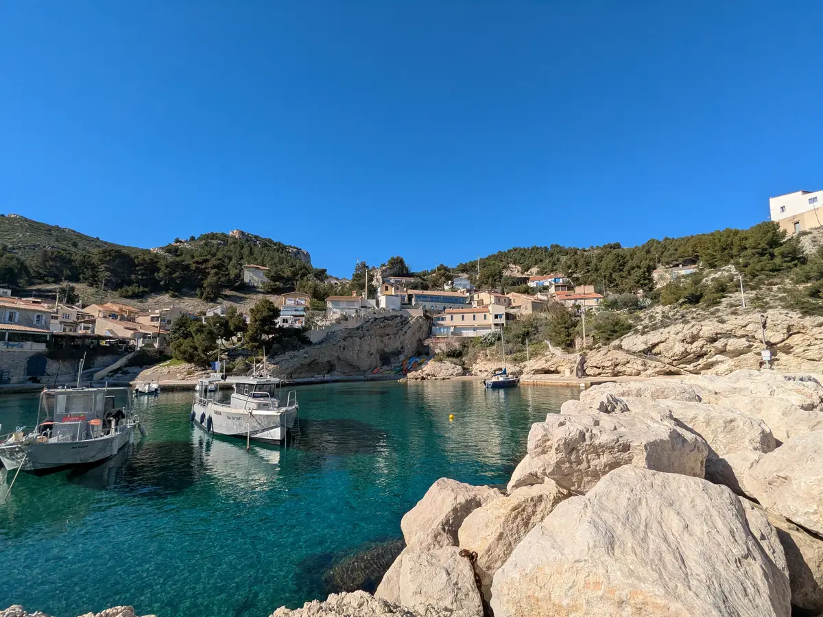
Houses and cabanons occupy the slopes around the quays. Steps and narrow passages link the homes to the boats moored in the cove. Across the water, Marseille stretches along the foot of its hills: the city is close, but the terrain long kept these small harbours away from major transport routes.

The Côte Bleue train along the cliffs
Opened in 1915, the line from Miramas to L’Estaque created a new coastal rail route into Marseille. It also brought rail access to the small harbours of the Côte Bleue.
Under engineer Paul Séjourné, viaducts spanned the ravines and tunnels pierced the rocky spurs. From the train, the sea appears between tunnels, before another viaduct crosses the next valley. At Niolon, the station stands just above the houses: a few minutes’ walk downhill takes passengers from the tracks to the harbour.

Guns to defend the bay
After its defeat in 1870, France strengthened its borders and the defences of its ports. Niolon’s upper battery, built in the 1880s, belonged to the system of fortifications associated with General Séré de Rivières. Standing at around 193 metres above sea level, it was intended to provide crossfire with the batteries on the Frioul islands, barring entry to the bay.
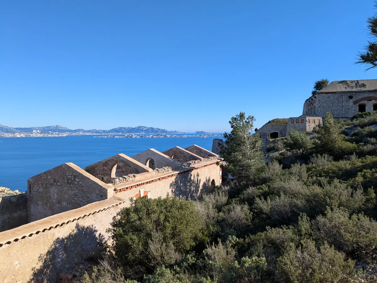
The fort contained gun positions, ammunition stores and barracks. Its rocky spur offered a view out to sea, while walls and earthworks protected the soldiers and stores. The buildings were equipped to withstand a siege lasting several weeks.
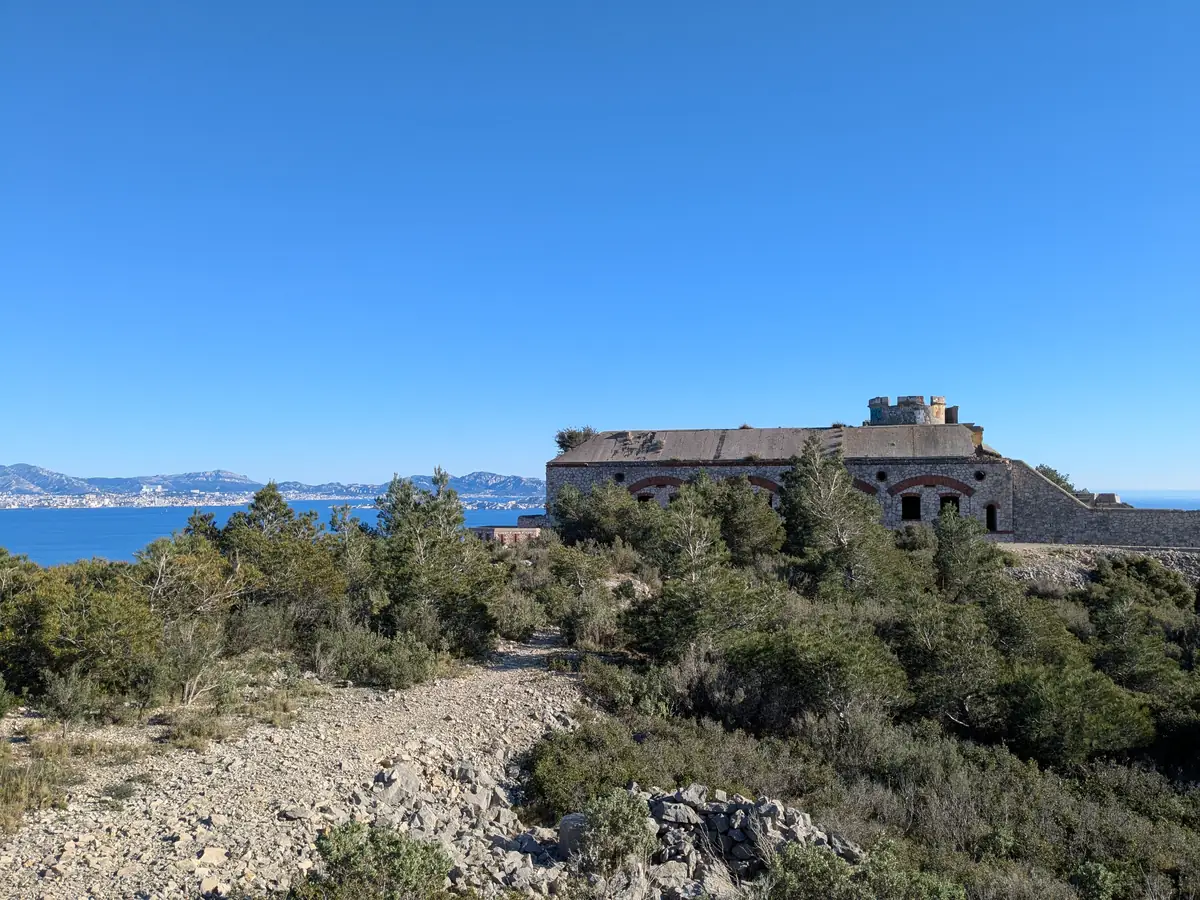
German forces occupied and modified the battery during the Second World War. Abandoned after the war, it now belongs to the Conservatoire du littoral coastal conservation agency. A path climbs from Niolon to the battery’s surroundings, with views of Marseille and the Frioul islands.
A coastline spared large-scale development
Beyond the village, paths lead from the pines onto scrub-covered slopes. Pale rock emerges between clumps of vegetation; ravines separate the headlands and small coves. Towards L’Érevine, the walk becomes a coastal hike, with rocky stretches and changes in elevation.
This landscape could have looked very different. In the 1970s, property companies planned more than 16,000 homes on large tracts of land in Le Rove and Ensuès-la-Redonne. Both municipalities prohibited building on these areas, and the Conservatoire du littoral began acquiring the land in 1980. The hills above the calanques were thus spared large-scale development.

Niolon, a renowned diving centre
Niolon also has a place in diving history: the first diving instructor examination was held here in 1957. Today, the UCPA centre occupies the former lower battery near the harbour and welcomes both beginners and experienced divers. Nearby sites feature limestone drop-offs and fissures where divers may see red coral in shallow water, along with spiny lobsters, octopuses and conger eels.
Continue towards Marseille and the Côte Bleue
West of Niolon, the Côte Bleue beaches around La Couronne and Carro form sandy coves between rocky headlands and pine woods.
Across the bay, the lanes of Panier district offer more of Marseille to explore. South of the city, Les Goudes has another small harbour surrounded by cabanons at the foot of the limestone hills.

Practical information
Planning a visit to Niolon
- Time
- Allow one to two hours for the harbour and its surroundings. The loop via the fort and La Vesse is a separate hike, listed by Marseille’s tourist office as 5.7 km and around two hours’ walking, excluding stops.
- Arriving by train
- Niolon station is served by Côte Bleue regional trains. Check station timetables and services for both your outward and return journeys.
- Scuba diving
- The UCPA centre in Niolon offers diving holidays and training courses. Contact the centre directly for programmes and visitor requirements.
- Driving and access
- From early May to late August, the municipality restricts daytime road access to Niolon and La Vesse on weekends and public holidays. Passes are reserved for residents. Check the municipal access arrangements; parking spaces are limited and signs must be respected.
- Battery and paths
- The path to the fort reaches its surroundings; the interior remains closed to the public. The coastal path to L’Érevine is a different route, with rocky and exposed stretches: see the municipal information about this path.
- What to bring
- Bring walking shoes, water and sun protection. Check woodland access restrictions related to fire risk.
To plan your visit: Marseille Tourist Office.
Extend your stay
Guest houses near the Côte Bleue
Discover guest houses in the area and visit the owners’ websites directly to plan your stay.
Last updated: