


Estérel: red rocks, coast and forested massif
The Estérel Massif, a red relief between Var and Alpes-Maritimes
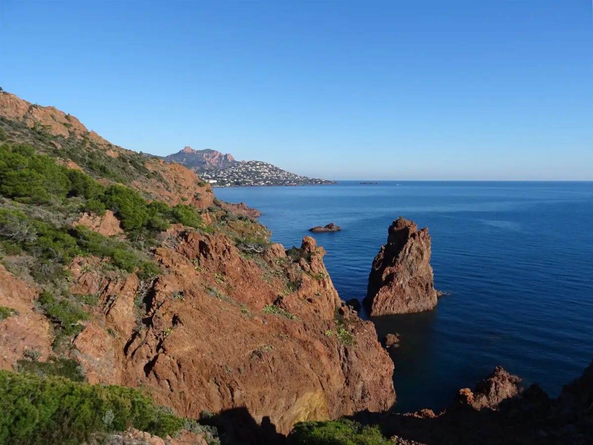
The Estérel Massif extends between the Var and Alpes-Maritimes, from Saint-Raphaël towards Mandelieu-la-Napoule. Its volcanic relief, about 320 sq km, reaches the Mediterranean through headlands, dry valleys, low ridges and narrow coves.
Rock, maquis and the Corniche d’Or
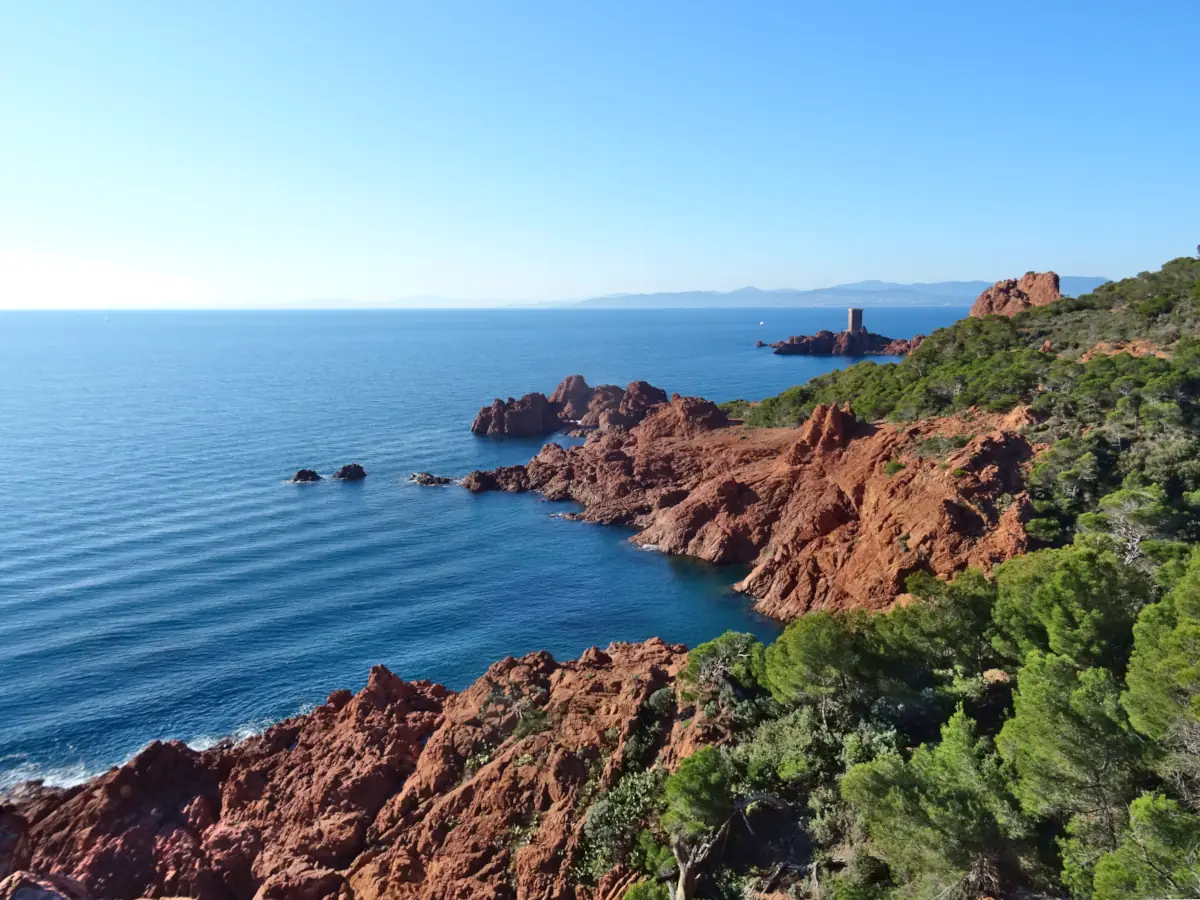
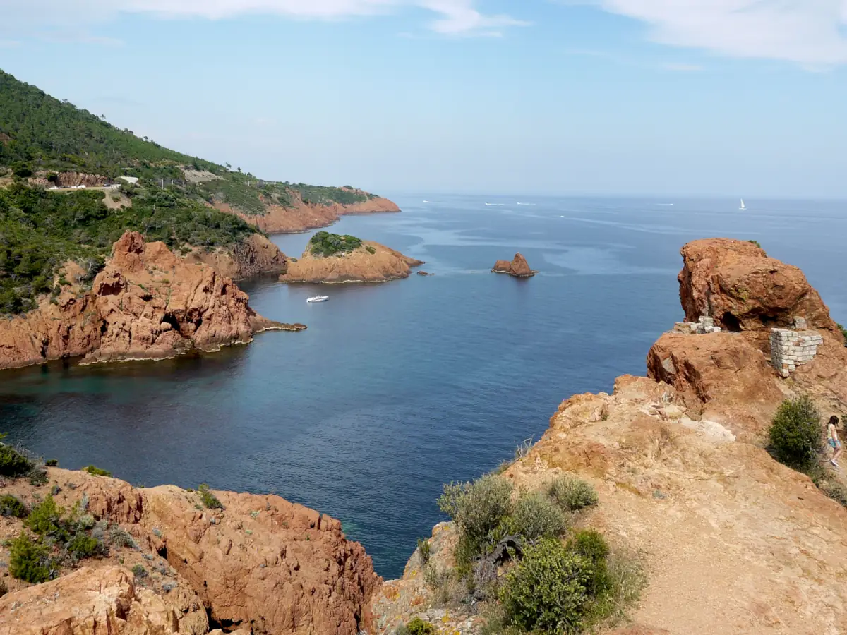
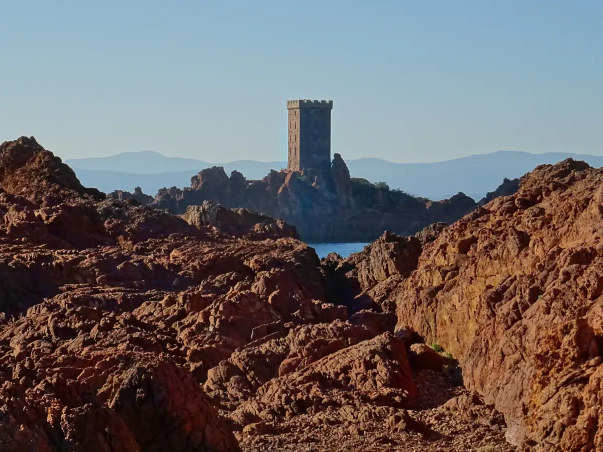
The colour of the Estérel comes from rhyolite, the red rock visible between Agay, Le Dramont, Anthéor and the Corniche d’Or. Set against pine trees, cork oaks and the sea, it gives the massif a clear visual identity. Access to coves, tracks and viewpoints remains dependent on seasonal conditions and fire-prevention rules.
Mont Vinaigre and ridge lines
Mont Vinaigre, the highest point at 612 metres, helps read the structure of the massif. Routes rise quickly from the coast or from Les Adrets-de-l’Estérel, crossing thin soils, maquis and Mediterranean woodland. Here, choosing the right season matters more than seeking altitude.
Tanneron and transition villages
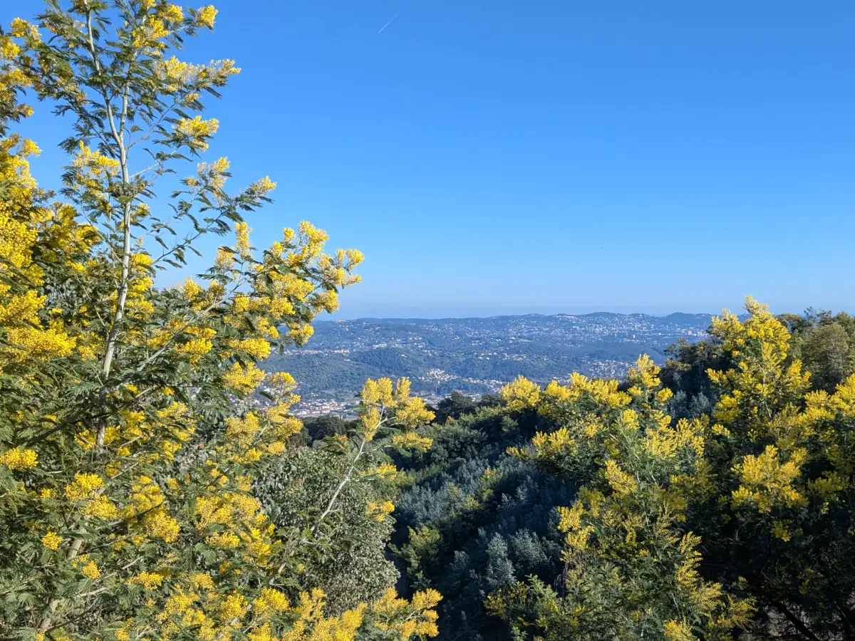
To the north, Tanneron forms the passage towards Pays de Fayence. Mimosa shapes the winter landscape, while hamlets and forest roads recall the older uses of these hills: passage, cultivation, woodcutting and access to inland villages.
Between coast and hinterland
The Estérel links the coast of Cannes, Saint-Raphaël bay, Pays de Fayence villages and routes towards the Massif des Maures. Choosing a bed and breakfast therefore depends on the pace you want: sea at first light, walking on ridges, or a quieter stay in the hills.
Bed and breakfast near the Estérel
Here is a selection of guest houses, gites and charming places to stay near the Estérel, between red rocks, forest and coastline, with direct access to each owner’s website.
 Charming Bed and breakfast
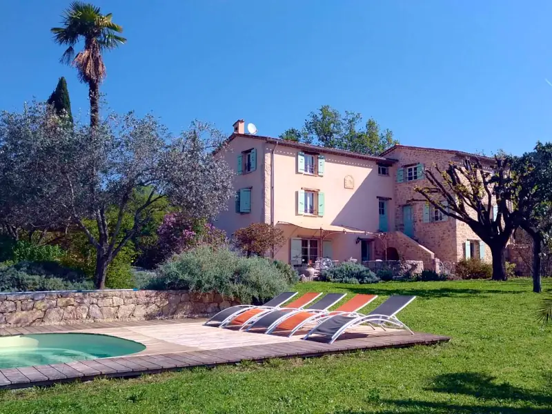
L'Escale Provençale
In the country of Fayence, three charming guest rooms in a superb listed 19th century building, in the heart of a 3500 m2 park, in Tourrettes, a picturesque and typically Provencal village, a stone's throw from the Lake of Saint Cassien. Swimming pool and large garden with trees.
Planning your stay in the Estérel
When is the best time to stay near the Estérel?
Spring and autumn suit walks and coastal roads. Winter is useful around Tanneron for mimosa flowering. In summer, access to the massif can be restricted according to fire risk.
Where should you choose a bed and breakfast near the Estérel?
You can stay around Saint-Raphaël, Agay, Les Adrets-de-l’Estérel, Tanneron, Pays de Fayence or routes leading to Cannes.
What can you do in the Estérel Massif?
You can follow the Corniche d’Or, walk to viewpoints, visit Le Dramont, see Tanneron mimosa in season and plan outings to Cannes or Saint-Raphaël.