


A getaway in the Southern Alps
Saint-Étienne-de-Tinée, from the village to the peaks of the Mercantour
Text and photographs by Vincent Flachaire
In the upper Tinée valley, the colourful houses of Saint-Étienne surround a large Baroque church. The Bonette road continues the journey towards the barracks of Les Fourches and the landscapes of the Mercantour.
Saint-Étienne, a small town in the upper Tinée
At around 1,150 metres above sea level, Saint-Étienne-de-Tinée stands on a terrace on the right bank of the Tinée, in the upper part of the valley. To the south, the road follows the Tinée and then the Var towards the outskirts of Nice. To the north, it climbs to the Bonette and crosses the mountains into the Ubaye, while Auron overlooks the town from its plateau.
This position below the passes long made Saint-Étienne a crossroads between valleys and an agricultural centre known for its fairs. The town already had 2,300 inhabitants in 1754 and ranked among the main settlements in the County of Nice. Alongside its church, it preserves several chapels and a former Trinitarian convent.
Saint-Étienne is also a stopping point for hikers travelling through the Alps. In the morning, they can be seen having breakfast before setting off again towards the heights and mountain lakes.

A Baroque church with a Gothic chancel
Saint-Étienne church was rebuilt in the late 18th century to plans by the Nice architect Antonio Spinelli. It retains the Gothic chancel of the previous building.
The façade and Baroque forms recall the links with the County of Nice, which became part of France in 1860.
In 1929, a fire devastated part of the village. Many French municipalities subsequently contributed to its reconstruction. The name of Rue des Communes de France recalls this solidarity.

Auron, the resort above the village
Higher up, Auron occupies a plateau open to the surrounding mountains. The creation of the ski resort in 1937 profoundly changed life in the municipality. From the village, the Pinatelle gondola provides a direct connection to the Auron ski area.
In summer, paths cross the area’s alpine pastures.

A detour to Saint-Dalmas-le-Selvage
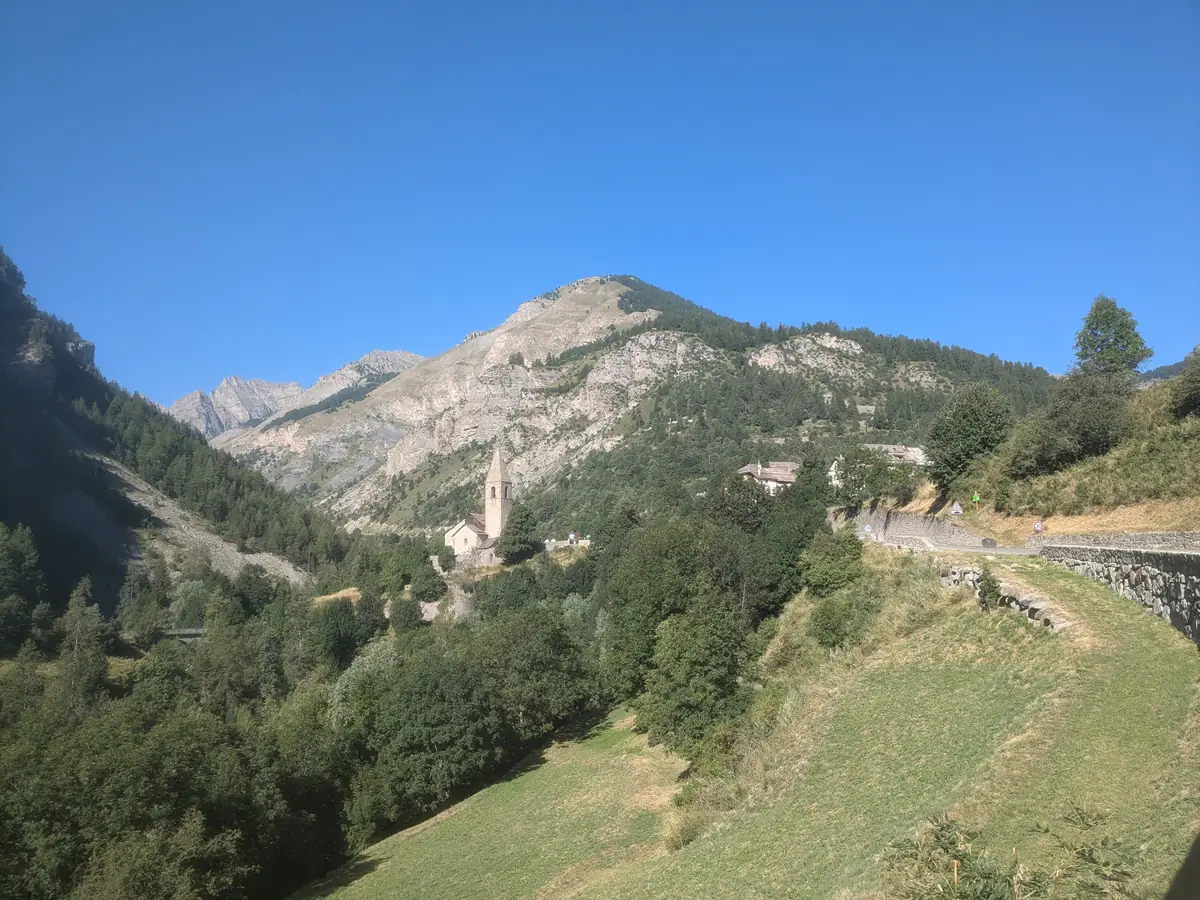
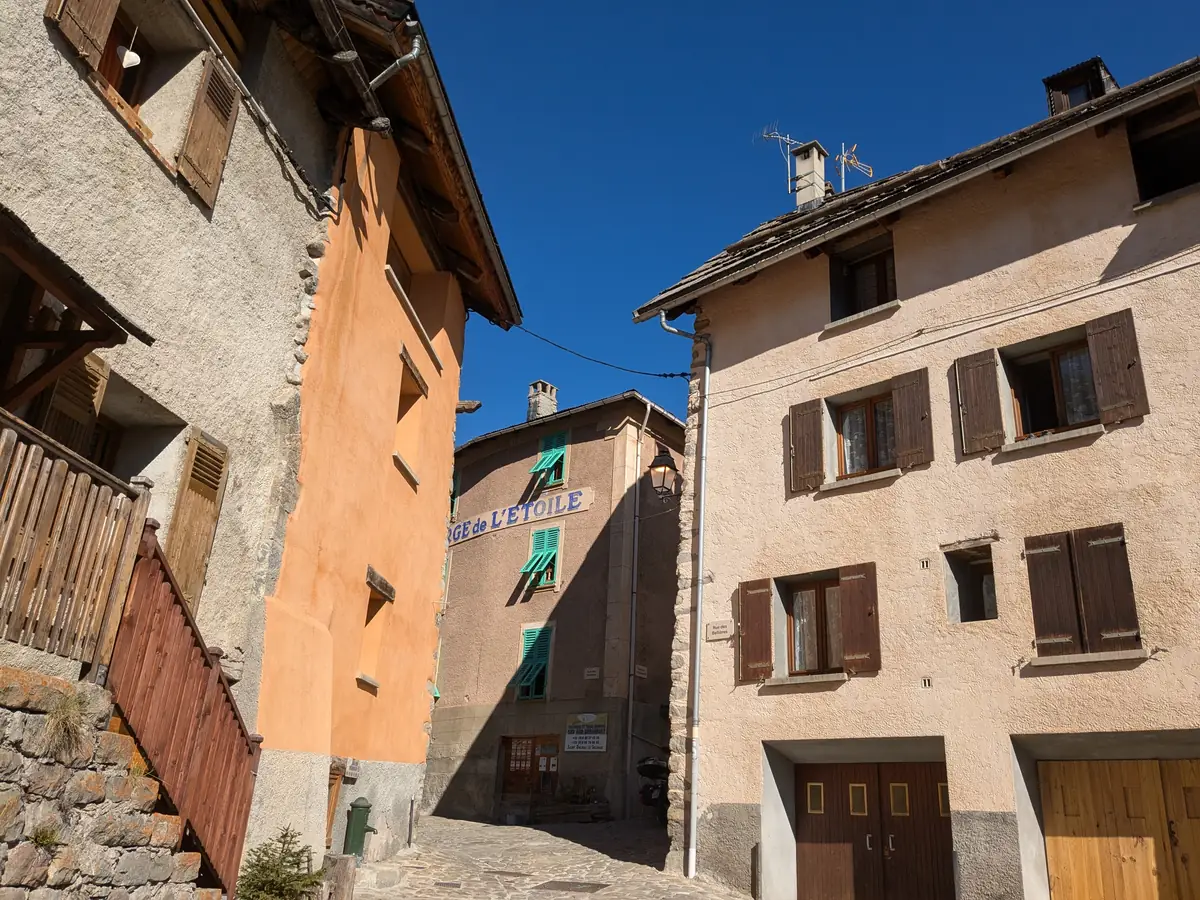
Away from the main Bonette road, Saint-Dalmas-le-Selvage clusters its houses at around 1,500 metres above sea level. Paved lanes run between houses with colourful façades and steep roofs suited to snowy winters. Sundials adorn several village houses.
The barracks of the Camp des Fourches
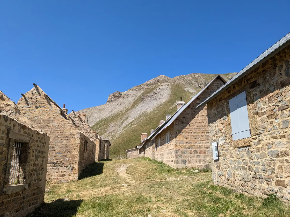
Further up the Bonette road, the barracks of the Camp des Fourches occupy a shelf amid the alpine pastures, at more than 2,200 metres above sea level. Developed from 1889 to house the Chasseurs Alpins, the camp allowed troops to carry out manoeuvres near the Italian border.
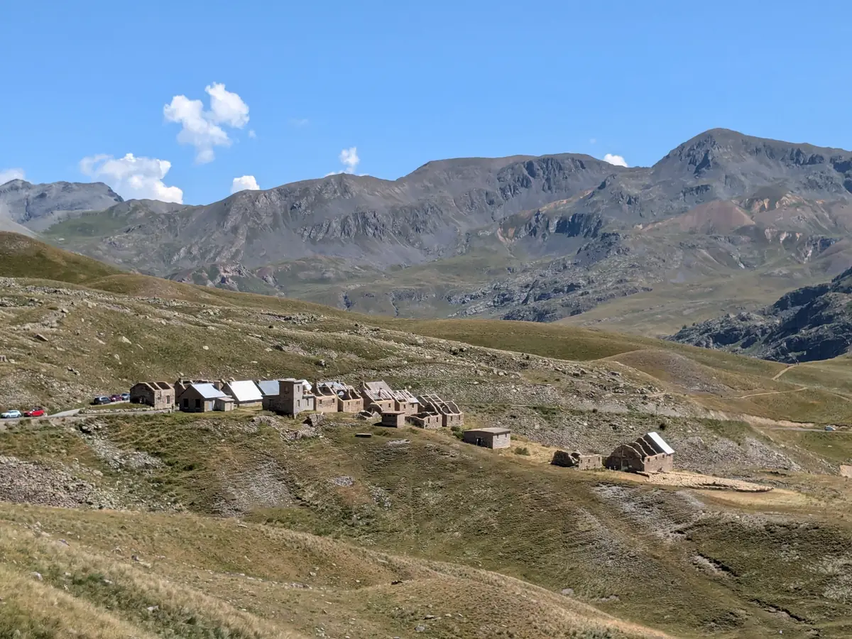
The companies initially stayed here during the warmer months. Between the two world wars, the installation of heating, a generator, a water supply and a cableway was intended to allow winter occupation. Snow cut the camp off for several months.
The Département carried out work to make the camp safe and restore it between 2016 and 2018.
The Bonette, from the pass to the summit
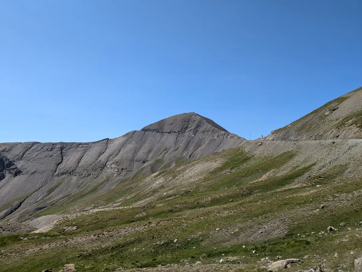
Beyond Les Fourches, the road climbs onto increasingly rocky slopes. Alpine pastures give way to scree and the dark slopes of the Bonette. The pass stands at 2,715 metres; a road loop then circles the peak and reaches 2,802 metres. The summit itself, at 2,860 metres, can be reached on foot from the road.
Continue towards the Ubaye or the mountain lakes
On the other side of the Bonette, the road descends towards Jausiers and the Ubaye valley. The journey can continue to Barcelonnette and its Mexican villas.
Around Saint-Étienne-de-Tinée, the lakes of Vens and Rabuons are reached on foot along mountain routes with changes in elevation. These hikes require suitable equipment and experience of mountain hiking.
Practical information
Planning a visit to Saint-Étienne
- Duration
- Allow one to two hours for the village, and longer for heritage visits. Set aside separate time for going up to Auron, driving the Bonette road or hiking.
- Access and parking
- The village is reached from Nice via the Var valley and then the Tinée valley. Car parks are signposted at the entrance to the town.
- Church and chapels
- Opening arrangements differ between buildings. See the religious heritage tours offered by the tourist office.
- The Bonette road
- The crossing is closed in winter and its opening depends on snow conditions. Stops at the Camp des Fourches and the Bonette require extra time beyond the village visit. See the information on the Bonette road and traffic conditions.
- Camp des Fourches
- The exterior can be visited freely when the road is accessible and conditions allow. The Département provides information on the history of the camp and visiting arrangements.
- In the mountains
- Bring water, walking shoes and warm clothing. Choose a hike suited to your experience; check the weather and trail conditions. To use the Pinatelle gondola or other Auron lifts, consult the tourist office for opening periods and return times.
To plan your visit: Auron and Saint-Étienne-de-Tinée tourist office.
Extend your stay
Guest houses near the Mercantour
Discover guest houses in the area and visit the owners’ websites directly to plan your stay.
Last updated: