


A getaway in the Southern Alps
The Upper Verdon, from Colmars to Lake Allos
Text and photographs by Vincent Flachaire
In the Upper Verdon, Colmars shelters its houses behind ramparts beneath forests and alpine pastures. Roads climb to the passes, while paths lead to Lake Allos in the Mercantour National Park.
The Upper Verdon, an Alpine valley
Far upstream from the great gorges and Lake Sainte-Croix, the Verdon rises above La Foux d’Allos. It descends between wooded slopes, passes through Allos and Colmars, then reaches Beauvezer. Villages occupy the valley floor, while side streams cut into the hillsides.
A cliffside path through the Saint-Pierre gorges
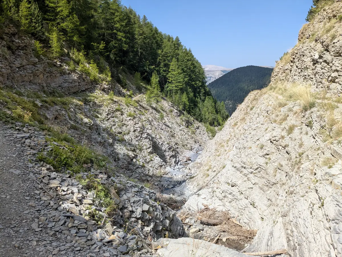
Near Beauvezer, the Saint-Pierre stream has carved a narrow passage between the cliffs. From Villars-Heyssier, the path climbs above the ravine, cut into the rock face. On either side, bare rock alternates with wooded slopes; the streambed remains far below for much of the way.

Upstream of the gorges, the rock walls open out and larches cover more of the slopes. The path reaches the former forestry huts of Congerman and Chabanal, now used as hiking stopovers. This succession of cliffs, ravines and forests gives the walk its variety.
Colmars facing the former border
Colmars stands at the confluence of the Lance and the Verdon. Its ramparts and two forts protected a town on the threshold of Savoy: in 1388, Allos, a few kilometres further upstream, came under Savoyard rule. Its permanent incorporation into France in 1713 moved the border away and reduced Colmars’ military importance.

Fort de Savoie was built between 1693 and 1695 to plans by engineer Richerand. During his visit in 1700, Vauban judged it ill suited to its purpose: the walls were too low and too thin, and the tower too narrow for cannon fire. He proposed more ambitious alterations, which were never carried out.
The alpine pastures of the Col des Champs
The Col des Champs road climbs through woodland above Colmars. Gradually, the trees thin out and pastures cover the slopes beneath rocky ridges. From the bends, the village houses cluster below in the middle of the valley.
The pass leads to the Val d’Entraunes and the upper Var valley. On the slopes, groups of larches frame grey gullies and alpine grassland. This open landscape contrasts with the narrow Saint-Pierre gorges and the streets sheltered behind Colmars’ ramparts.

Lake Allos, a legacy of the glaciers
Above Allos, the lake path crosses larch woodland and follows the wet Laus plateau. At 2,228 metres above sea level, water fills a basin carved by glaciers beneath the Tours du Lac. High rock walls enclose the cirque, while grassland and rocky shores border the lake.
The lake has no visible outflow at its edge. Its water seeps underground, then reappears lower down at the source of the Chadoulin, a tributary of the Verdon. The Laus plateau also preserves traces of a former lake, gradually filled in and turned into a peat bog.

Continue towards the Ubaye and the Verdon
Above Allos, the Col d’Allos opens the road to Barcelonnette and the Ubaye valley. Downstream, the Verdon leads towards the gorges and Lake Sainte-Croix. At Sainte-Croix-sur-Verdon, houses overlook the lake’s beaches in a more southerly landscape.
Practical information
Planning a getaway in the Upper Verdon
- Time
- Allow several days to combine villages, passes and hikes. One to two hours is enough for a walk around Colmars, excluding guided visits.
- Roads and passes
- The Col des Champs links Colmars to the Val d’Entraunes; the Col d’Allos leads to Barcelonnette. Both roads are seasonal. Check Val d’Allos access conditions before travelling. Roadworks or snow may affect connections.
- Access to Lake Allos
- From the Laus car park, when open, the hike including the circuit of the lake is listed as around three hours’ walking, excluding stops. Starting from a lower car park increases the time and elevation gain. Access to Le Laus is regulated, limited and subject to a fee depending on the season. Check the lake visitor information.
- In the National Park
- Swimming in Lake Allos is prohibited. Dogs, even on a lead, are prohibited in the Park’s core area, apart from exceptions provided for in the regulations.
- Saint-Pierre gorges
- The path is narrow and exposed to drops. Rain, ice or snow can make the passages dangerous. Check the hiking information and access conditions; adapt your route to your experience and the weather.
- What to bring
- Walking boots, water, sun protection and a warm or waterproof layer. Mountain weather can change quickly. Village visits remain an alternative when conditions prevent heading higher.
To plan your visit: Verdon Tourist Office.
Extend your stay
Guest houses in the Verdon area
Discover guest houses in the area and visit the owners’ websites directly to plan your stay.
Last updated: