The Montagne de Lure, in the southwest of the Alpes-de-Haute-Provence department, extends the Mont Ventoux eastwards towards Sisteron and the Durance Valley. Often compared with the Ventoux for its shape and landscapes, the massif rises to 1,826 metres. East of the mountain, the Citadel of Sisteron offers a further stop overlooking the Durance valley.
A natural climate boundary
The Montagne de Lure marks a transition between the southern slope, with a more Mediterranean character, and the northern slope, already more Alpine as it descends towards the Jabron Valley. This position creates contrasting landscapes, from sunny hills to wooded slopes and open ridges.
Lure villages and rural Haute-Provence
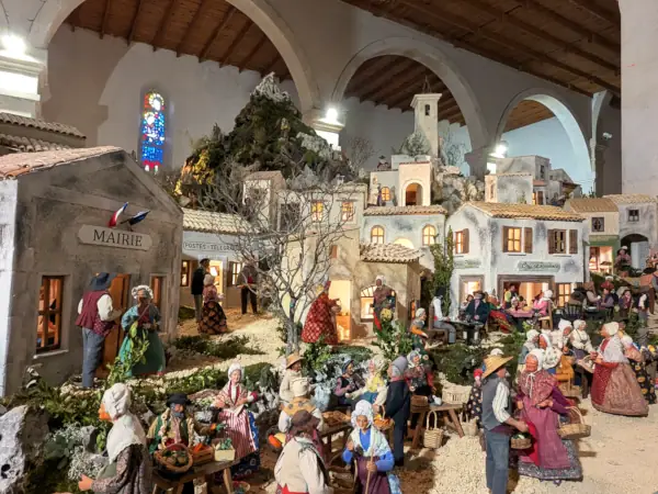
At the foot of the southern slope, Banon, Ongles, Saint-Étienne-les-Orgues, Cruis, Mallefougasse and Châteauneuf-Val-Saint-Donat form a landscape of villages, lavender, olive trees, forests and pastures. Further south, Forcalquier is a useful base for markets, heritage and Haute-Provence scenery. At Christmas, the Banon nativity scene recreates the village and woodland activities of the surrounding area.
Hiking, ridges and mountain activities
The Montagne de Lure is suited to hiking, cycling, forest walks and scenic routes. Trails lead from oak and pine woods to the open summit grasslands. In winter, the small Saint-Étienne-les-Orgues station, at around 1,572 metres, may offer snow activities depending on conditions.
Notre-Dame de Lure Abbey
Deep in the forest, at about 1,200 metres, Notre-Dame de Lure Abbey, founded in 1166, recalls the religious history of the massif. This shaded and isolated site is a quiet stop for understanding the link between mountain, heritage and rural life.
South of the mountain, the Monday market in Forcalquier offers produce from Haute-Provence, from the Bourguet to Place Saint-Michel.



 Meals with the hosts