Getaway in the Luberon
The Mirabeau Bridge, a historic crossing of the Durance
Text and photographs by Vincent Flachaire
At the Canteperdrix gorge, the Durance narrows between limestone cliffs. Ferries, suspension bridges and a modern road bridge have followed one another at this crossing from the Luberon towards the Aix region and Haute-Provence.
The Canteperdrix gorge, an eastern gateway to the Luberon
At Mirabeau, the Durance passes through a rocky bottleneck that gives the landscape an immediate sense of power. On its right bank, the hills mark the eastern end of the Grand Luberon. Across the river, Jouques opens towards the Pays d’Aix and Montagne Sainte-Victoire. Upstream, the valley leads towards Manosque, Haute-Provence and the roads to the Verdon. The river separates several territories here, while the gorge concentrates the routes that connect them.
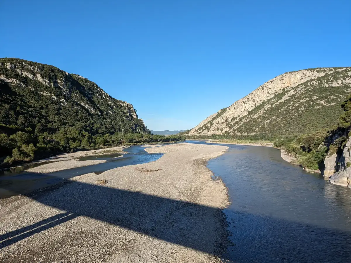
From the bridge, the bed of the Durance appears broad and changeable, divided into channels and gravel bars. As it reaches the Canteperdrix gorge, this open space contracts between limestone walls. The terrain created a natural crossing on a route linking the Rhône valley, the Luberon, Aix-en-Provence and the roads of Haute-Provence.
This setting explains the importance of the site. For centuries, the Mirabeau Bridge has occupied a threshold on the routes between the two banks. Travellers and goods had to contend with the breadth of the riverbed, the changing current and the narrowness of the gorge.
Crossing the Durance before the bridges
An old route from Aix-en-Provence to Riez already ran through the gorge. From the first half of the 13th century, rope ferries provided the crossing. Attached to a cable, the boat used the force of the current to reach the opposite bank. This system avoided working directly against the river, but it remained dependent on water levels, floods and shifts in the channel.
The course of the Durance was far less regulated than it is today. Its channels moved across a very broad bed of gravel, and rising water could interrupt traffic. Standing above the river, the Sainte-Madeleine chapel recalls the age of this link and the risks faced by travellers.
A first attempt to build a bridge is documented in the 15th century. Structures erected in the gorge were later destroyed, wholly or in part, by the floods of 1440, 1635, 1843 and 1881. The Canteperdrix bottleneck made it easier to connect the banks without removing the constraints imposed by this Alpine river. The need to cross the Durance and the difficulty of controlling it shape the entire history of the Mirabeau Bridge.
From suspension bridges to the portals left on the banks
After several early 19th-century proposals, a suspension bridge was built between 1832 and 1835. Its deck, about 150 metres long, crossed the Durance without an intermediate support in the riverbed. Swept away by the major flood of 2 November 1843, it was rebuilt from 1845 onwards. The flood of 1881 caused further damage.
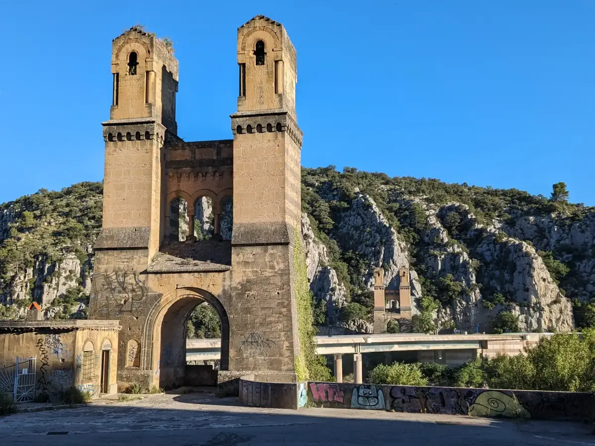
The two portals still standing today belonged to this 19th-century bridge. Their Romanesque Revival design borrows from medieval architecture: a large round arch opens between two massive towers pierced by tall, narrow openings, while small arches and rows of corbels articulate the upper sections. This monumental composition also served a technical purpose, as the suspension cables were anchored in the powerful masonry. The portals have been listed as historic monuments since 6 July 1982.
On the Mirabeau bank, the portal reads as a monumental gateway. On the same axis, the present road bridge crosses the Durance along a much lower, horizontal line. The suspended deck that once connected the portals was not the bridge destroyed during the Second World War: no longer suited to traffic and superseded by newer structures, it was decommissioned and removed. The surviving masonry still reveals its width, alignment and original approach.
A crossing rebuilt as the river and traffic changed
The succession of bridges shows how closely a crossing depends on the river beneath it. At Mirabeau, floods repeatedly damaged or swept away structures. In 1935, a new single-span bridge was completed with two reinforced concrete pylons. Standing 22 metres high, they carried sculptures and reliefs by Antoine Sartorio representing the four departments around the site.
In August 1944, Allied aircraft tried to cut the bridge in order to slow the German retreat. After several days of unsuccessful bombing, Resistance fighters blew it up on 17 August. An American pontoon bridge was installed three days later, and the bridge was rebuilt in 1947. Increasing road traffic eventually led to its replacement by the present bridge, which opened in 1990.
The contrast still marks the site today. The surviving remains tell of repeated efforts to maintain a durable route through a landscape long governed by the movements of the Durance.
The Sainte-Madeleine chapel above the crossing
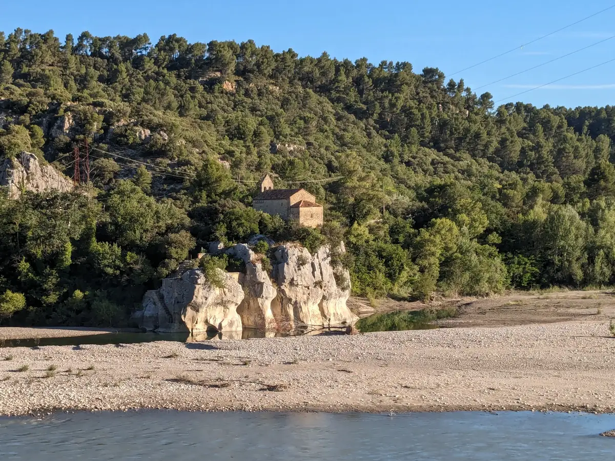
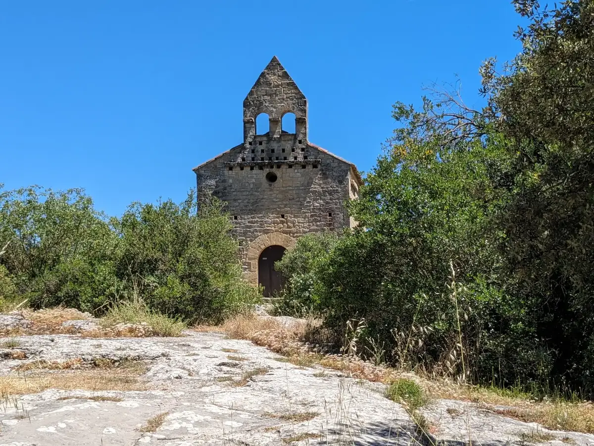
Downstream from the bridge, on the right bank, the Sainte-Madeleine chapel stands on a small rocky outcrop above the Durance. Its restrained masonry, apse and two-opening bell gable emerge among the oak trees. The Romanesque building overlooks the former crossing without aspiring to the monumentality of the bridge portals.
Its presence recalls a time before the suspension bridges. From this rise, the chapel overlooks the river, the gravel bars and the entrance to the gorge. Its position connects it with the long history of the crossing, when movement between the banks still depended on the conditions imposed by the Durance.
Seen from the riverbank, it appears simple and isolated in the landscape. Closer to the building, the stone of its façade and the rocky path leading to it connect the chapel with the same limestone landscape as the walls of Canteperdrix. It forms a quiet counterpoint to the larger structures built across the river.
From Mirabeau to the Pays d’Aix along the Durance valley
The Mirabeau Bridge occupies a distinctive position in the Luberon. To the west, the road reaches the Lourmarin combe, which crosses the range, then the villages of the southern slopes around the Cucuron pond and Lourmarin. To the east, the Durance valley continues towards Manosque and Haute-Provence. Across the river, Jouques opens the road towards the Pays d’Aix and Montagne Sainte-Victoire.
This setting gives the site a significance that extends beyond its heritage alone. The Mirabeau Bridge illustrates how the landscape and the river have shaped movement and travel in Provence: the river forms a natural boundary, the narrow pass concentrates the routes, and each engineering structure reflects the needs of its time.
The arcades, the road bridge, the chapel, and the meanders of the water flowing through its pebble-strewn bed all tell the story of this crossing at the foot of the Luberon, where roads had to contend with the Durance before continuing on toward Aix or the Alps.
Extend your stay
Guest houses between the Luberon and the Pays d’Aix
The Mirabeau Bridge stands on the route linking the Luberon, the Durance valley and the Pays d’Aix. A stay near Lourmarin gives access to the southern side of the range, while Aix-en-Provence provides a base for continuing towards Jouques and the landscapes of the Durance.
These properties listed on the Portal are within 25 km as the crow flies of the location featured in this getaway. Visit their websites to plan your stay.
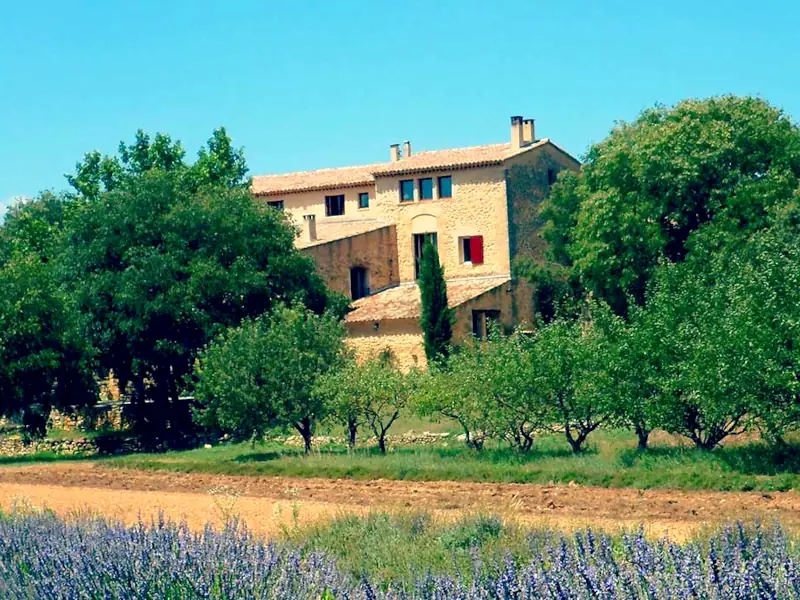

La Ferme
Charming bed and breakfast
Saint-Marc-Jaumegarde
Visit website