


A getaway in the Aix region
The Roquefavour Aqueduct Carries the Marseille Canal Above the Arc
Text and photographs by Vincent Flachaire
Above the trees of the Arc valley, Roquefavour’s three tiers of arches carry the Marseille Canal. A walk along the canal leads to the remains of the oppidum and viewpoints over the structure.
Three tiers of arches above the Arc
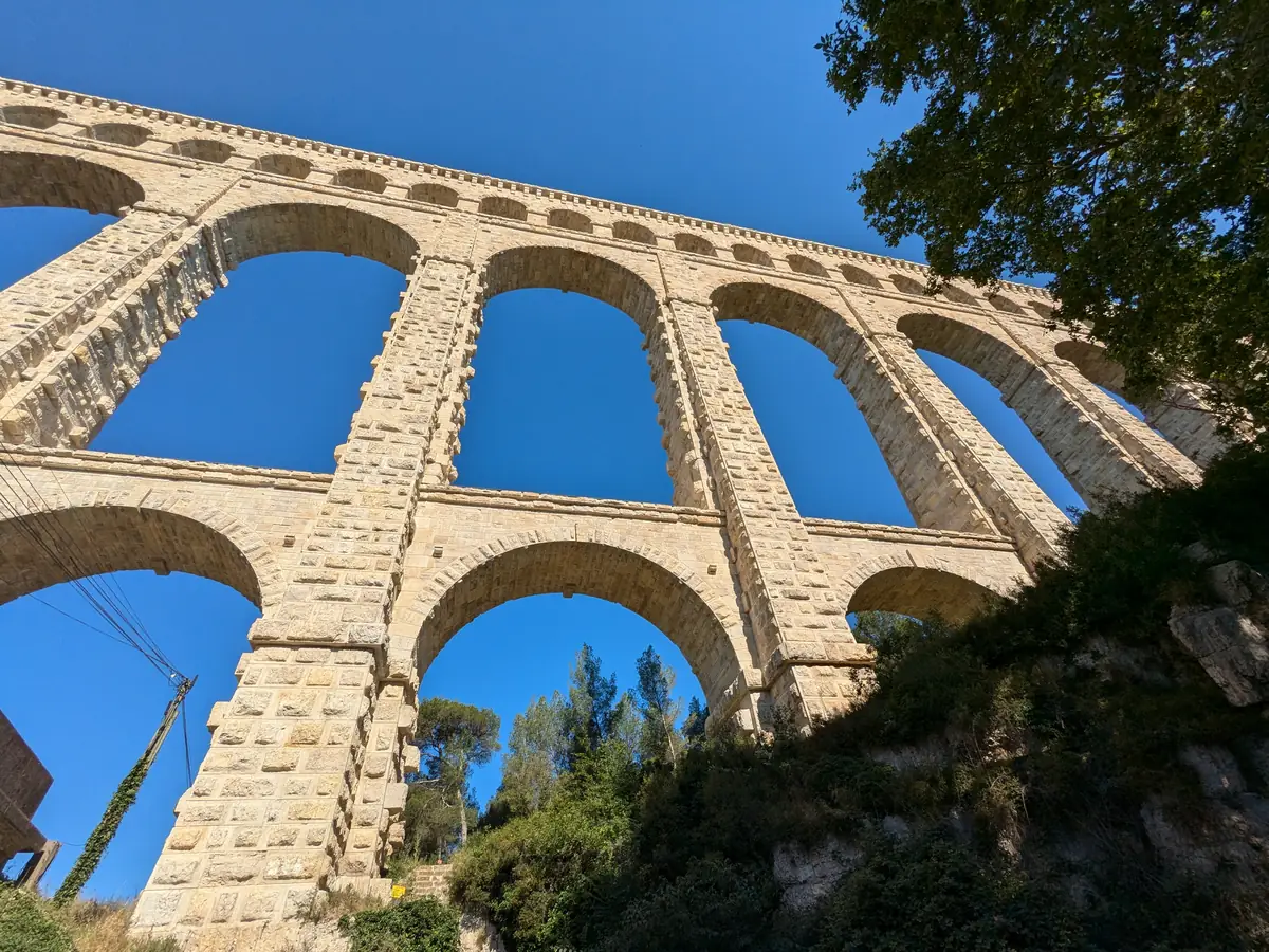
From the meadows in the valley, you can follow the arches from one hillside to the other. At the foot of the piers, the great arches tower above you, while the openings on the upper tier look much smaller. The Marseille Canal runs along the very top.
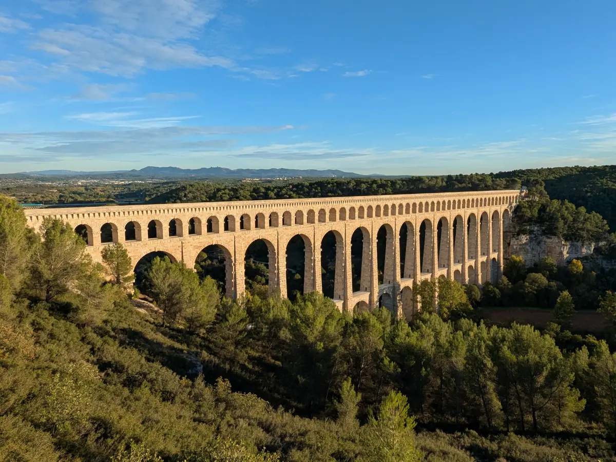
Built between 1841 and 1847, the structure is 375 metres long and almost 83 metres high. Its three stone tiers recall the Pont du Gard.
Bringing water to Marseille
In the 1830s, Marseille suffered from water shortages and several epidemics. In 1834, mayor Maximin-Dominique Consolat decided to bring water from the Durance. Engineer Franz Mayor de Montricher took charge of the works and moved into a country house at Roquefavour to oversee construction.
Construction of the Marseille Canal ran from 1838 to 1851. Completed in 1847, Roquefavour Aqueduct provided a crossing over the Arc. Water from the Durance first reached Marseille in 1849, as the Musée d’Histoire de Marseille recounts. It flows by gravity throughout the route: tunnels pass through the hills and aqueducts carry the canal across the valleys.
A railway to transport the stone
A nine-kilometre railway was built to bring stone blocks from the quarries at Velaux to the construction site. Some stones weigh up to fifteen tonnes: they had to be transported, dressed and then hoisted into position.

An aqueduct still in service
The aqueduct still carries water for Marseille and neighbouring towns, which is treated before distribution. Maintaining the arches and canal therefore remains essential to the local water supply.
Completed in May 2024, the restoration replaced the most damaged stones and renewed the structure’s waterproofing. Runoff and seepage had weakened masonry exposed to the weather since the 19th century.
From the Marseille Canal to the Roquefavour oppidum
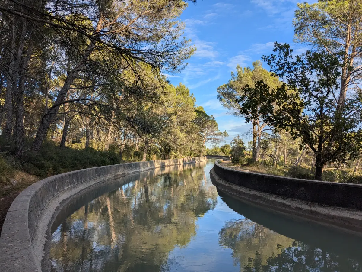
The Chemin des Grandes Terres provides vehicle access to the area around the Marseille Canal. The walking route follows the canal, then a DFCI forest fire access track to the viewpoint over the aqueduct. Another route starts in Ventabren and passes through the oppidum, known as Camp de Marius.
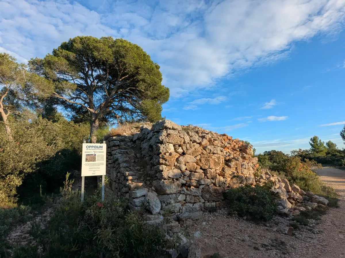
Perched around 180 metres above sea level, the oppidum occupies a rocky spur of about six hectares that once controlled the passage between the lower Arc valley and the Berre lagoon. Archaeological information published by the town of Ventabren records occupation from the 3rd century BC.
The fortified settlement was most active in the 1st century BC before being abandoned in the closing decades of that century. Its name, Camp de Marius, comes from local tradition: the remains do not establish that the Roman general was present here.
At the far end of the plateau, the view opens out over the aqueduct and the Arc valley. After the pine-lined canal and the remains of the oppidum, you see the structure from above, its arches linking the two hillsides. On the horizon stand the distinctive outline of Sainte-Victoire, the Sainte-Baume massif and the Étoile range.
Continue to Ventabren and Aix-en-Provence
After exploring the aqueduct and oppidum, continue into the narrow streets of the hilltop village of Ventabren. In Aix-en-Provence, the Four Dolphins Fountain and the Mazarin quarter invite you to stroll among the grand townhouses, while the Place Richelme market brings the old town to life in the morning. To return to the trails of the Aix region, head towards Sainte-Victoire, further east.
Practical information
Discover Roquefavour Aqueduct
- Location and parking
- The aqueduct crosses the Arc valley and the RD 65 road between Ventabren and Aix-en-Provence. The Department’s 2020 parks guide mentions a car park at the foot of the structure.
- Suggested duration
- A stop in the valley takes around 30 to 45 minutes, excluding a hike on the higher ground.
- Access via the Chemin des Grandes Terres
- Vehicle access to the area around the canal, followed by a walk alongside it and along the DFCI forest fire access track to the viewpoint over the aqueduct.
- Hike from Ventabren
- From the Parking des Brès: a 9 km round trip, 3 hours and 256 metres of elevation gain, according to the Provence Tourisme route description.
- Access to the hills
- Access conditions for the Bouches-du-Rhône hills.
To plan your visit: Ventabren tourist information.
Extend your stay
Guest houses around Aix-en-Provence
These properties listed on the Portal are within 25 km as the crow flies of the location featured in this getaway. Visit their websites to plan your stay.

Campagne Chastel
Charming bed and breakfast and Gite
Aix-en-Provence
Visit website

La Ferme
Charming bed and breakfast
Saint-Marc-Jaumegarde
Visit websiteLast updated: