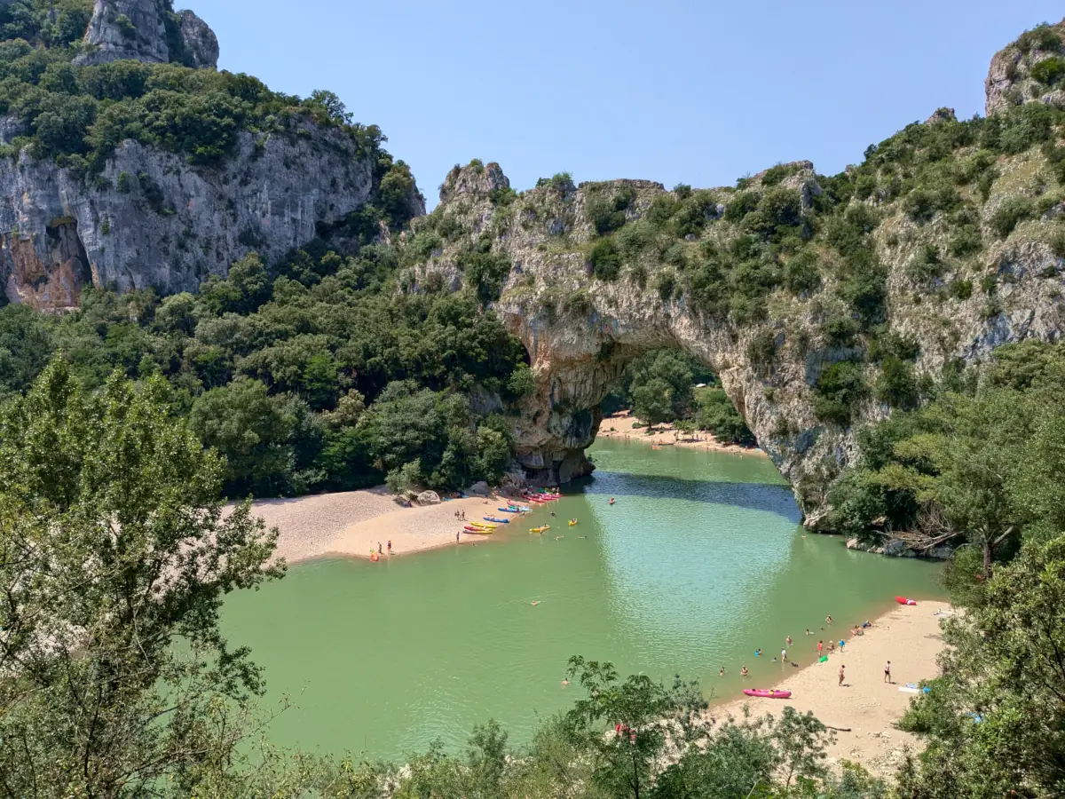
The Gorges de l’Ardèche run for about twenty-five kilometres between Vallon-Pont-d’Arc and Saint-Marcel-d’Ardèche. The river has carved the limestone plateau into broad bends, sometimes below cliffs over two hundred metres high. Pont d’Arc, a natural arch opened through the rock, marks the best-known entrance to the canyon.
Pont d’Arc, viewpoints and gorge road
The tourist road follows the left bank and provides several viewpoints, including Serre de Tourre, La Madeleine and Ranc-Pointu. Each stop reads the site differently: river curve, limestone tables, dry vegetation, pebble beaches and deep shade at the foot of the cliffs.
Chauvet Cave and prehistoric traces
The area is also linked to Chauvet Cave, listed as a UNESCO World Heritage Site. Its paintings, around 36,000 years old, are not visited in the original cave, but the Caverne du Pont d’Arc replica explains their importance. Caves, sinkholes and shelters recall the depth of human presence in this relief.
River, canoeing and trails
Canoe descents of the Ardèche range from a few hours to two days, depending on season, water level and chosen organisation. Trails require more attention: heat, rocky passages, protected areas and reserve regulations call for careful, respectful preparation.
Nature reserve and nearby villages
Classified as a national nature reserve since 1980, the gorges protect cliffs, holm oaks, boxwood, cliff-nesting birds, beavers and river habitats. Around the canyon, Vallon-Pont-d’Arc, Saint-Remèze, Aiguèze, Saint-Martin-d’Ardèche and villages of southern Ardèche allow a stay between water, stone and plateaus.



 Meals with the hosts